Drone real estate photography has gone from a luxury add-on to an expectation for many listings, and nowhere is that more true than in the mountains of Western North Carolina. When a property’s best feature is the land it sits on, the long view it commands, or the way a ridge folds into the Blue Ridge horizon, ground-level photos simply can’t tell the story. An aerial perspective can. This guide covers what drone photography actually shows buyers, which properties benefit most, and the FAA and licensing basics every agent should understand before hiring a pilot.
What Drone Real Estate Photography Actually Shows
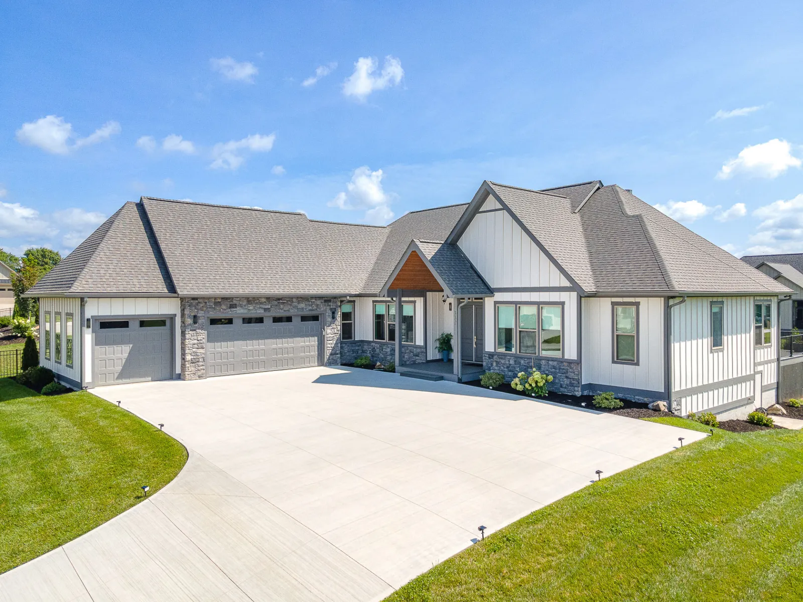
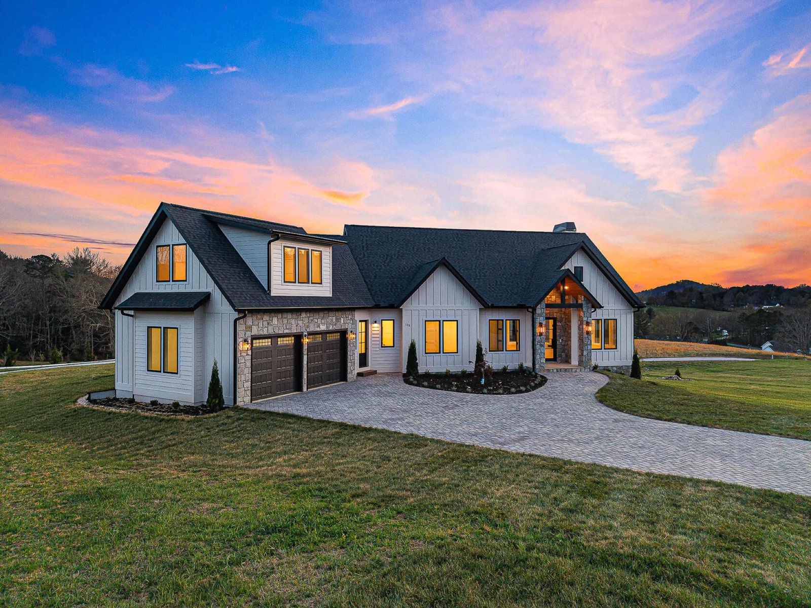
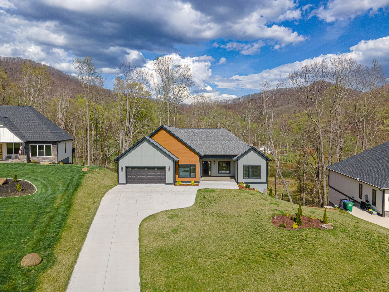
A camera six inches off the ground sees a yard. A camera 150 feet up sees a property in its full context. That difference is what makes aerial imagery so persuasive for buyers scrolling listings online. Instead of guessing how a home relates to its surroundings, they see it instantly.
Good aerial coverage communicates several things a standard photo set never can:
- Lot size and boundaries — buyers grasp how much land they’re really getting, and where the property lines fall relative to neighbors and tree lines.
- The setting and views — long-range mountain vistas, pastures, ponds, and the way the home is oriented toward the best sightlines.
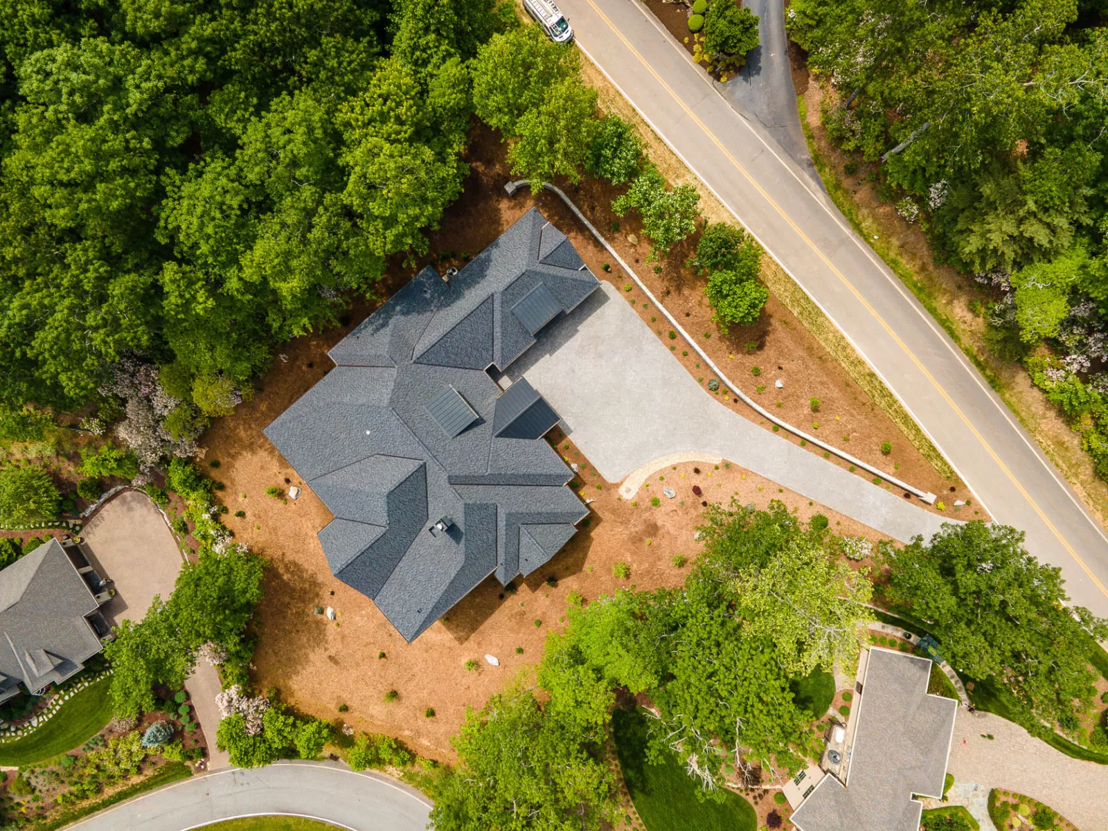
- Roof and exterior condition — a clean overhead pass shows the roof, gutters, and outbuildings without anyone climbing a ladder.
- Proximity and access — how the driveway runs, where outbuildings sit, and how close the property is to roads, water, or trails.
- Layout of acreage — fenced areas, cleared building sites, and usable versus wooded land all read clearly from above.
Which Properties Need Aerial Coverage
Not every listing requires a drone. A 1,200-square-foot townhome on a quarter-acre lot is usually served fine by exterior ground shots. But several property types gain real selling power from the air, and in our region they show up constantly.
Acreage and Land Listings
When you’re selling five, ten, or fifty acres, the land is the product. Aerial photography is the only honest way to show its scale and shape. Buyers want to see the pasture, the wooded sections, the building envelope, and how it all connects. For raw land with no structure to photograph, drone imagery is essentially the entire visual case for the listing.
Mountain Lots and View Properties
This is where Western NC shines. A home in Black Mountain, Fletcher, or Weaverville might sit on a slope with a panoramic view that a ground-level lens can’t capture through the trees. An aerial shot at the right elevation reveals exactly what a buyer would see from the deck on a clear morning. For mountain acreage around Asheville, Mills River, and Horse Shoe, that long Blue Ridge view is often the single most valuable feature, and it deserves to be photographed properly.
Waterfront and Distinctive Settings
Creek frontage, a pond, a river bend, or proximity to a lake all read beautifully from above. So do estates, equestrian properties, and homes with notable landscaping or hardscape. Anytime the relationship between the home and its surroundings is part of the value, aerial coverage pays for itself.
FAA and Licensing Basics You Should Know
Commercial drone photography is regulated by the FAA, and hiring the right pilot protects you and your seller. Here’s what matters in plain terms.
Any drone flown for commercial purposes, including marketing a real estate listing, must be operated by a pilot holding an FAA Part 107 Remote Pilot Certificate. This is not optional, and it’s not the same as a hobbyist flying for fun. A licensed pilot has passed an aeronautical knowledge exam and understands airspace rules, altitude limits, and operating restrictions.
Airspace is the other piece. Parts of Western North Carolina sit near controlled airspace, including the area around Asheville Regional Airport in Fletcher. Flying there can require advance authorization through the FAA’s LAANC system. A professional pilot checks airspace before every shoot, secures any needed clearance, and knows when a location simply can’t be flown. Drones are also limited to 400 feet above ground level in most conditions and must keep clear of people and obstacles.
The practical takeaway for agents: ask whether your photographer is Part 107 certified and insured. A properly licensed, insured pilot keeps your listing’s marketing clean and your liability covered. It’s a simple question that separates a professional from a neighbor with a hobby drone.
Ready to Show Your Listing From Above?
If you have a property where the land, the views, or the setting deserve to be seen the way they really are, we’d love to help. Pavlov Photo provides licensed, insured aerial drone photography for real estate across Asheville and all of Western North Carolina, with next-day delivery and a 5.0 Google rating. Call Sergey at (828) 767-2422 to book a shoot or talk through what your listing needs. We’ll make sure your property looks its best from every angle.